
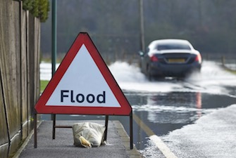
 The most common type of severe weather emergency that affects American citizens and property owners is flash flooding, according to the National Flood Insurance Program. Flash floods, which can be caused by torrential downpours or the failure of man-made structures like dams or levees, causes rapid flooding of a low-lying area within six hours of the flood’s precipitating event. Half of all flash flooding fatalities are vehicle-related. The 30-year average for fatalities from flooding as of 2014 was 81 per year, the highest among all weather-related deaths in America. It should be noted that hurricanes and tornadoes each have higher 10-year averages than floods and that no 30-year average is maintained for heat-related deaths, which has the highest 10-year average with 124 deaths per year. Still, it’s clear that flash flooding is a major concern among severe weather events in America.
Even without fatalities, flooding visits plenty of hardships on anyone it touches. Texas flooding in late May of this year killed two and also destroyed up to 400 homes and forced the evacuation of 2,000 people. Excessive rain through late July led to early August flooding in the Tampa Bay area, swamping usually busy interstates and prompting the city to distribute sandbags to residents. In the first week of September, strong storms dumping heavy rains led to flash floods in four states: South Dakota, Wisconsin, Arizona and Texas. With a coming El Niño that could dump a heavy amount of rainfall on southern California this winter, we wanted to revisit our Disaster Tech series to take a closer look at some flood management innovations being pursued to aid those in areas prone to flooding.
The National Weather Service (NWS), a program of the National Oceanic and Atmospheric Administration (NOAA), keeps an eye on the height of rivers and streams through a network of 10,000 streamgages that monitor the levels of waterways all over the United States. Specialized streamgages known as Automated Local Evaluation in Real-Time (ALERT) streamgages are designed to send a warning signal when they detect a rapid change in water level. ALERT streamgages, which have been in use since the 1970s, include water level, temperature and wind sensors which deliver data to a base station through line-of-sight radio communications. ALERT gages also incorporate tipping bucket rain gauges, which tip over every time .04 inches of rain accumulates in the bucket. Every time it tips, a signal is sent to the base station to indicate local rainfall.
Flooding is not a problem which is endemic solely to America and the global community has shown an interest in pursuing research and development for this sector. This March, Berlin hosted the 2015 Wasser Berlin International, an annual symposium on water management, and this year’s event included a heavy focus on flood management innovations. The flood management section of this expo involved a number of exhibitors showing off flood barriers, coastal protection systems and disaster management services. One such exhibitor was StormTrap LLC of Morris, IL, a developer of stormwater management solutions. StormTrap’s underground stormwater detention products stores runoff water in underground chambers before being released at a controlled rate. The company also make underground stormwater retention products which differ slightly as they slowly discharge water into soil.
Another exhibitor listed at the 2015 Wasser Berlin International was FloodProtect, a regional flood risk reduction planning project based in California’s Lower Sacramento Delta North region. FloodProtect works to overcome shortcomings which have become typical of regional flood management planning, including organization, funding and long-term vision. By the summer of 2014, the organization began a phase of developing a regional flood management plan for submission to the California Department of Water Resources (DWR) which includes a list of prioritized projects and a financial plan evaluating the local economic and real estate climate. FloodProtect aims to achieve 200-year flood protection in urban areas and 100-year flood protection in rural areas for areas of four California counties: Sacramento, Yolo, Solano and Sutter.
A devastating and lethal 1953 flood in the Netherlands was instrumental in prompting flood management reforms in that country over the last six decades, an important consideration in a country where half of the land is below sea level. The Dutch government spent $8 billion over the course of 25 years to construct a robust system of seawalls and dams that shortened the country’s coastline by 400 miles, greatly reducing the amount of land vulnerable to flooding. The system incorporated the use of three storm surge barriers which operate 63 hydraulically-powered sluice gates reaching 20 feet tall to hold back the North Sea during a storm surge.
The 1953 North Sea flood also hit parts of England, damaging 24,000 homes, killing 307 people and prompting flood prevention engineering in that country as well. The country engaged in a number of infrastructure improvements in the following years, including construction of the Thames Barrier which was completed in 1982. This structure, a series of 10 metal gates, sits along the banks of the Thames River as it runs through London. When water levels are high, hydraulic systems lift each gate from its position on the floor of the Thames until it blocks the river from running upstream towards the city center. The gates can also take an underspill position which allows a controlled amount of water to pass under the gate. More than 1.1 million Britons are also registered with the Floodline Warnings Direct system which freely provides warnings to citizens about flood conditions developing in their area.
During the 1997-98 El Niño phenomenon, some coastal areas of California received more than 25 inches of rain between December 1997 and February 1998. In February 1998 alone, downtown Los Angeles received 13.68 inches of rain, more than four times the historical average for that month. There is no definitive measure of how much rainfall causes flash flooding as local infrastructure and topography play a huge role in the susceptibility of a geographical region to flash flooding. The risks of death and property damage that can be caused by floods are significantly raised in urban areas and southern California has plenty of those.
Over in Orange County, just southeast of Los Angeles, flood management falls under the responsibility of the Flooding Division of Orange County Public Works. This department designs and installs drainage-related facilities like channels, storm drains and pump stations. One of OC Flood’s current projects is the relocation of the Santa Ana River Interceptor (SARI) Line, a wastewater line that serves Orange as well as parts of San Bernardino and Riverside counties, bringing waste to the Orange County Sanitation District. The SARI Line was constructed in the 1970s, since which time erosion has removed large amounts of the 20 feet of soil under which the line was buried. A four-mile segment of the SARI Line running up to the border between Orange and San Bernardino counties is in particular risk of failure in the event of heavy rains. The project will result in the relocation of the main SARI Line at that section of pipeline, replacing the line with a 54-inch-diameter pipeline that will be laid north of the Riverside Highway.
This year marks one century since California’s state legislature adopted the Los Angeles County Flood Control Act, itself prompted by a massive flood in 1914 that caused $165 million in property damage. LA’s Flood Control District handles flood protection and aesthetic enhancement for an area stretching over 3,000 square miles and encompasses 2,800 miles of underground storm drain. In recent years, this agency has diverted engineering resources towards the creation of a series of massive stormwater drains, like the system of six-foot-tall boxes installed 30 feet under the ground of Sun Valley Park, located just a few miles northwest of Burbank, CA. Installed in 2007, this particular drain connects to the water supply so that collected stormwater is available as drinking water within a few years. A five-year project undertaken by the county’s flood management agency will also look to remove 1,000 cubic yards of sediment from the Devil’s Gate Dam reservoir, located just a few miles away from downtown Los Angeles.
At the municipal level, the latest floodplain management plan for the city of Los Angeles, developed by LA’s civil engineers, notes several issues in the city’s current flood planning. The 2015 report points out deficient mapping that doesn’t adequately reflect LA’s true flood risk and no mapping of the city’s stormwater/urban drainage flooding risk. The U.S. Geological Survey creates flood maps, which map out the flooding risk in a locale, using light detection and ranging (LIDAR) technology that pulses a laser tens of thousands of times per second from an overhead point to determine elevation in an area to within one foot. Mapping of fluid flow also requires computer modeling techniques and TrimR2D modeling techniques are often used to provide two-dimensional models of water flow through a floodplain. The various pieces of floodplain data are processed by a geographic information system (GIS), which can take LIDAR data and process the TrimR2D modeling technique to provide a map indicating the potential height of water levels as well as information on when flooding will arrive and when it will crest.
![[Advertisement]](https://ipwatchdog.com/wp-content/uploads/2024/04/Patent-Litigation-Masters-2024-sidebar-early-bird-ends-Apr-21-last-chance-700x500-1.jpg)

![[Advertisement]](https://ipwatchdog.com/wp-content/uploads/2021/12/WEBINAR-336-x-280-px.png)
![[Advertisement]](https://ipwatchdog.com/wp-content/uploads/2021/12/2021-Patent-Practice-on-Demand-recorded-Feb-2021-336-x-280.jpg)
![[Advertisement]](https://ipwatchdog.com/wp-content/uploads/2021/12/Ad-4-The-Invent-Patent-System™.png)


Join the Discussion
No comments yet.