
Editorial Note: This article generally address the California drought and the impending El Niño, which some are predicting could be the strongest ever on record. This article, a part of our Disaster Tech series, is part 1 of a multi-part series that will look at various aspects of the California drought, focusing on reservoir technologies, flash flood prevention and other associated innovations. Stay tuned!
_______________
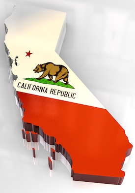 As of the week August 18th, 99.86 percent of the state of California was experiencing some form of drought. More than 90 percent of a state measuring nearly 164,000 square miles is experiencing levels of severe drought or worse. Nearly half of the entire state is experiencing exceptional drought as defined by the National Drought Mitigation Center. Compared to a year earlier, when more than 58 percent of California was in exceptional drought, the situation is slightly better but ever-tightening water supplies are starting to make a real impact on agriculture and other industries in the state with the strongest economy in America.
Conditions of drought often bring with them both long-term and short-term consequences. After a year or so of drought, groundwater supplies start to be used up at a rate faster than rainfall can replace it. This is typically when streams, aquifers or any water feature, all of which are typically connected to groundwater sources, begin to lower and dry up. In the long term, groundwater reservoirs that have been emptied must be refilled with water or the risk of land shifting increases, creating a potentially hazardous situation on the surface while eliminating space that could have been useful as an underground reservoir. Low groundwater reserves also creates the threat that seawater could enter an aquifer system and foul the water. Dry conditions have definitely resulted in an increase in forest fires which are currently engulfing thousands of acres across the state; some forest fires in California this year have spanned tens of thousands of acres. In addition, extremely dry conditions have led to the deaths of 6.3 million trees stretching across the Sierra Nevada foothills with a full 20 to 30 percent of trees in that region either dying or dead, providing plenty of fuel for wildfires.
Given all this, it is understandable why so many people would feel relief after having been told that some forecast models are showing an upcoming weather event which could dump a great deal of rain all over the region. Multiple forecast models compiled by the National Oceanic and Atmospheric Association (NOAA) as well as the International Research Institute for Climate and Society are showing that an El Niño weather pattern could dump more water on parts of southern California than the last great El Niño in 1997-98. That one dropped a record amount of rainfall, almost 14 inches in one month in Los Angeles alone.
El Niño is so called because of the South American fishermen who first noted the phenomenon of excessive rainfall occurring every couple of years starting just after Christmas; “the little boy” is a reference to the fact that the event would happen after the celebration of the birth of Christ. There have been calls for caution from climatologists, some of whom point out that a forecasted El Niño, even a strong one, does not necessarily mean that water is on the way. As one California state climatologist has pointed out, the data showing that El Niño is on the way correlates with seven other years, three of which were wetter than average, three drier than average, and one with average rainfall. In their words, the chances that El Niño might cause any extra rain at all is about as good as a coin flip. If only 36 inches of rain fell on California from El Niño, as was the case with the 1992 version of this weather event, then California would get less rain than normal and the drought would likely worsen.
The warmer Pacific Ocean waters caused by El Niño, along with it’s sister weather pattern La Niña, which brings cooler temperatures to the Pacific, are part of a weather pattern known as the El Niño/Southern Oscillation (ENSO). ENSO is a weather pattern set off by a chain reaction of atmospheric events involving heavy interaction between the atmosphere and the world’s oceans. According to NOAA, the first step of ENSO occurs with the heavy formation of cumulonimbus clouds, which are indicative of heavy water convection and can lead to large amounts of rainfall, in tropical regions, indicating a rise in sea surface temperatures. When these cumulonimbus clouds form, the circularity of the surrounding atmosphere shifts to adjust for the new climatological flow of the rain-heavy clouds. Major anomalies of convection occur within a few degrees of the equator but atmospheric mass and energy from the event can extend thousands of miles towards either pole, into the subtropical regions. Patterns of alternating waves of both low and high pressure reach north into the Pacific regions of North America and down towards South America.
There are numerous misconceptions about what El Niño is and isn’t. As we’ve already pointed out, an El Niño event doesn’t necessarily correlate with an increase in wetter weather, although when it does happen the rainfall can be pretty dramatic. For another thing, El Niño itself doesn’t actually hit North America. The equatorial weather pattern causes a shift in jet stream direction that make different areas more susceptible to storm patterns.
We may not know the extent of rainfall California will receive for several months, but it has been made abundantly clear that El Niño is definitely coming. Anomalies in positive equatorial sea surface temperatures have been occurring across the Pacific Ocean this year and they’ve indicated a 90 percent chance of an El Niño event in the Northern Hemisphere occurring this winter, with an 85 percent chance that it will remain until the spring.
Reports of an increase in the evidence of shark encounters along the coast of California, while harrowing on its own, could be indicative in a rise in oceanic temperatures in that region of the Pacific. Fears over the weather have also been changing entertainment plans for some. The 2016 Dakar Rally, billed as the world’s toughest motor sports race and held in January, is changing its venue from Peru to Argentina and Bolivia because of fears that El Niño will hit Peru with great force.
Even if we were to experience a wet and active El Niño this year, it wouldn’t likely be a healing salve for the entire state of California. El Niño’s effects are strongest in the southern parts of California. In the central and northern parts of the state, rainfall amounts aren’t really affected all that much. That’s an issue for those hoping for a silver bullet drought cure as much of the state’s water supply is collected in reservoirs north of San Francisco.
Of course, excessive rain in densely populated urban environments always poses the dangerous threat of flash flooding, which could be especially bad given the prolonged California drought. In addition, much of the road and building infrastructure reduces the amount of land that can suck up water runoff and that runoff can achieve a dangerous critical mass as it seeks its way back into either the ocean or groundwater supplies. With much of California’s water reservoir system in the central and northern parts of the state, those basins will be unable to help capture excessive rainfall, which could mean real disaster for parts of Southern California. Flooding and other weather events from the last El Niño killed an estimated 2,100 people around the world and caused more than $33 billion USD in property damage. NOAA has already issued an above-average flood watch for the Sierra Nevada region running along the eastern part of the state.
As fall approaches and the effects of El Niño begin to be felt, we’ll be checking in on this topic from time to time. In our Disaster Tech series, we’ll look at some of the technological advances made in the field of flash flood warning and prevention. We’ll also profile California’s water management system closely to see just how well they’ll be able to manage what could be a four-month influx of excessive rain. We will also take a look at various reservoir technologies and ask whether California has done enough to mitigate, to at least some extent, the inevitable periods of drought the State periodically faces.
Stay tuned!

![[Advertisement]](https://ipwatchdog.com/wp-content/uploads/2024/04/UnitedLex-May-2-2024-sidebar-700x500-1.jpg)
![[Advertisement]](https://ipwatchdog.com/wp-content/uploads/2024/04/Artificial-Intelligence-2024-REPLAY-sidebar-700x500-corrected.jpg)
![[Advertisement]](https://ipwatchdog.com/wp-content/uploads/2024/04/Patent-Litigation-Masters-2024-sidebar-700x500-1.jpg)

![[Advertisement]](https://ipwatchdog.com/wp-content/uploads/2021/12/WEBINAR-336-x-280-px.png)
![[Advertisement]](https://ipwatchdog.com/wp-content/uploads/2021/12/2021-Patent-Practice-on-Demand-recorded-Feb-2021-336-x-280.jpg)
![[Advertisement]](https://ipwatchdog.com/wp-content/uploads/2021/12/Ad-4-The-Invent-Patent-System™.png)


Join the Discussion
No comments yet.